Q U I E T S O F T™
.
O R B I T A L
.
C A L C U L A T I O N S
.
L I B R A R Y
.
S C R E E N S H O T S
Note: controls, buttons, menus, ribbon, and scroll bars removed from screenshots for clarity.
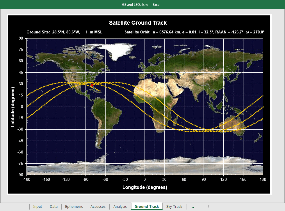
G R O U N D
.
T R A C K
This plot shows the ground track of a LEO satellite (yellow dotted lines)
as well as the specified ground site location (red diamond). It is taken from one of the example workbooks
included with this software product. This example satellite has the same orbit parameters as Friendship 7,
John Glenn's flight, on February 20, 1962. The ground site is Cape Canaveral Air Force Station.
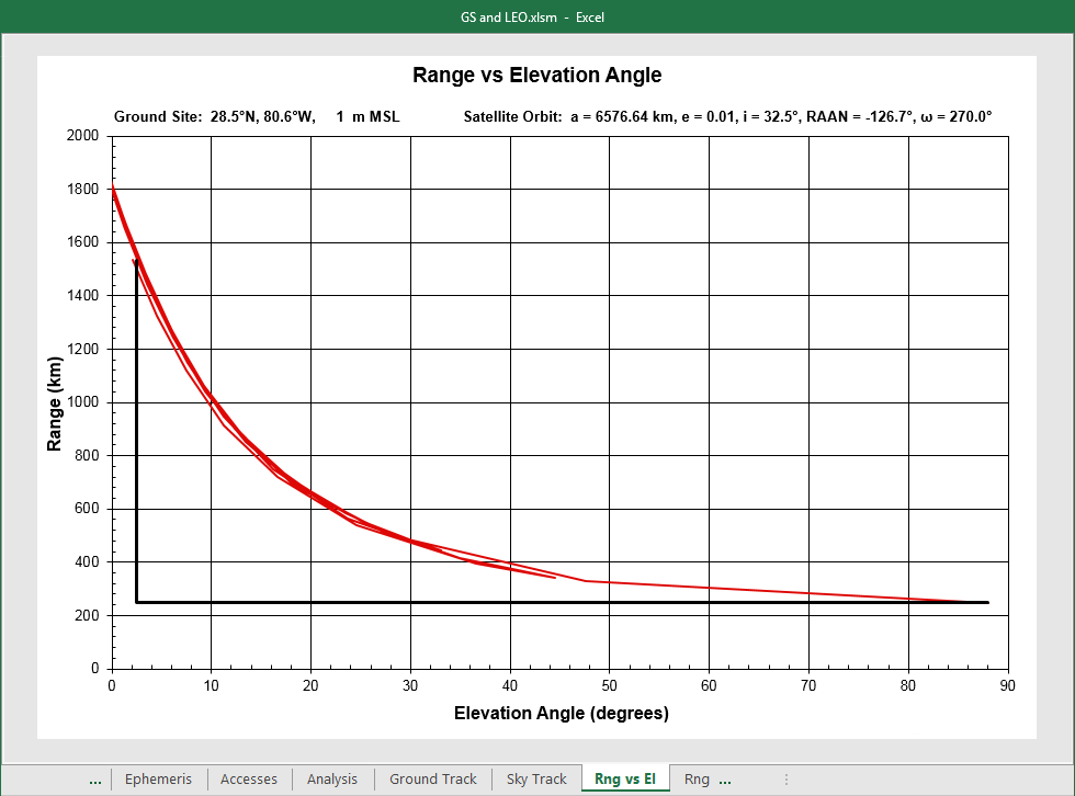
R A N G E
.
V E R S U S
.
E L E V A T I O N
.
A N G L E
This plot shows the satellite range versus elevation angle relative to
the ground site. This data is useful for analyzing communication link performance. The vertical part of
the thick "L" shaped black line is the specified minimum elevation. The satellite is in-view above and
to the right of this line. The satellite can be at low elevation and high range simultaneously,
indicating worst-case link conditions are near satellite rise or set. Usually this is the case, but not
always. It depends on the orbital parameters and ground site location.
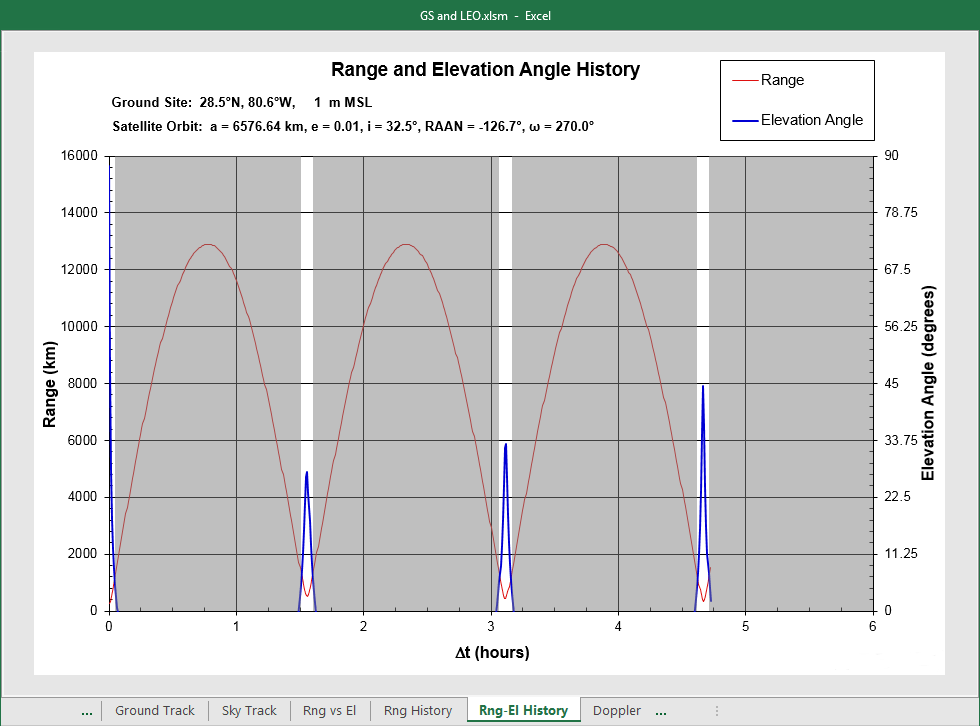
R A N G E
.
A N D
.
E L E V A T I O N
.
H I S T O R Y
This plot shows the satellite range and elevation angle history
relative to the ground site. This data is useful for analyzing communication link performance versus
time (e.g., orbit averaged availability, OAA). The blue elevation angle history line shows when the
satellite is in-view or out-of-view. Each in-view pass lasts only a few minutes as expected for a LEO.
Gray areas in the plot indicate that the satellite is out-of-view.
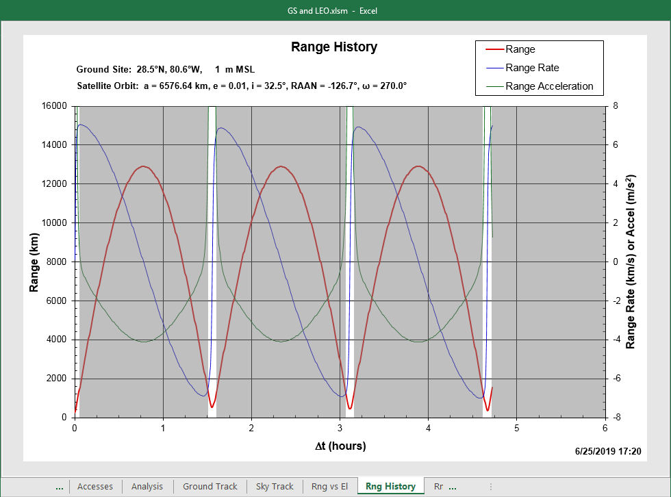
R A N G E
.
H I S T O R Y
This plot shows the satellite range, range rate, and range acceleration
history relative to the ground site. It shows how far the satellite is from the ground site, how fast it
is moving toward or away from the ground site, and how fast it is accelerating toward or away from the
ground site. Gray areas in the plot indicate that the satellite is out-of-view.
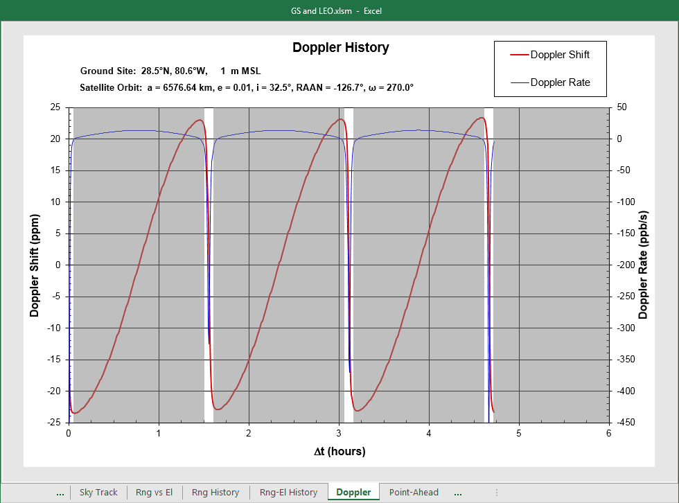
D O P P L E R
.
H I S T O R Y
This plot shows the fractional Doppler shift and Doppler rate history
for this satellite relative to the ground site. This is useful for determining communication hardware
(e.g., phase-locked loop) performance requirements. Gray areas in the plot indicate that the satellite
is out-of-view.